Callahan Mine Superfund Site Tailings Impoundment Investigation & Stability Analysis
Overview
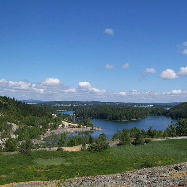
The Callahan Mine site comprises 150 acres in a coastal, rural setting in Brooksville, Maine, and abuts a large tidal area. Large waste rock piles, a tailings pond, and mine operations were abandoned in 1972 and the large pit mine was flooded when the dam to Goose Pond was released. Since that time, trace metals have been identified above human and other biota risk levels throughout soil and sediment at the Site (in addition to the waste rock piles), and PCBs were identified at elevated concentrations throughout the mine operations area.
Challenge
The stability of the onsite tailings impoundment represented a source of onsite contamination and its seismic instability was a threat to the adjoining Goose Pond. The configuration and geotechnical properties of the tailings impoundment was unknown and represented a significant data gap hindering remedial evaluation and design of Operable Unit 1 (OU1) of the Site.
Solution
Credere completed the final design of remedial actions at OU1 of the Callahan Mine Superfund Site as a subcontractor to Charter Contracting. This work included final cover system design, final grading design, and storm water management design for the ore pad area and other areas disturbed by the OU-1 remediation. This work also included field oversight for the removal and onsite disposal of the Ore Pad and lead contaminated residential soils, and the removal and onsite disposal of PCB contaminated surface soil to meet the Maine DEP Remedial Action Guidelines and TSCA PCB requirements. Finally, an extensive geotechnical investigation was performed by Credere to support the future remedial actions at the tailings impoundment area.
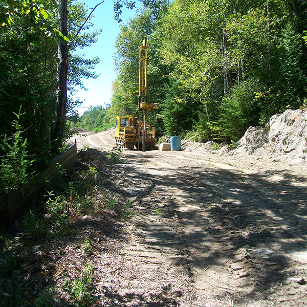
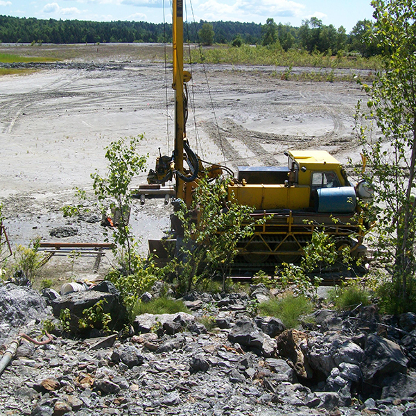
The geotechnical investigation consisted of the characterization and evaluation of the subsurface soil properties throughout the tailings impoundment, specifically determining the thickness and strength parameters of the glaciomarine silt-clay deposit and the tailings; locating the transition, extent, thickness of sand-tailings to mixed-tailings to slimes; determining the hydrological conditions throughout the impoundment; defining the geometric configuration and geotechnical properties of the perimeter berm material; and establishing the existing static and seismic stability of the tailings impoundment using Geo-Studio Slope/W modeling software, and evaluating the feasibility of relocating residential and/or ore pad material to the impoundment as part of OU1 remedial action. The field investigation program included the excavation of 22 test pits, 28 soil borings, the installation and monitoring of 13 overburden monitoring wells and 3 bedrock wells, installation and monitoring of 11 vibrating wire piezometers, and the collection of data from 33 seismic/piezocone penetrometer tests (SCPT/CPTs).
Results
The results of Credere’s geotechnical investigation is currently being used to support the design, remediation, and closure of the tailings impoundment. Work is anticipated to be implemented in 2019.